There must be something about the last week of August that causes us to lace up the hiking boots. In 2019 on this week, we were hiking in the Galápagos. 2018 found us exploring Greenways and parks of Knoxville, and in 2017 we were finishing up explorations around Cusco in Perú and about to tackle the Inca Trail to Machu Picchu. August of 2016 really started it all, when the mad decision to hike the Inca Trail got us to start seriously hiking, rather than just taking daily walks.
In this Year of the Pandemic, we decided to finally take a hike in the nearby Great Smoky Mountains Park. After all, we have lived in the Knoxville area for about two years now, and we had yet to set foot on any of the Park’s trails. We have taken drives through various access points, but no hiking.
Part of that was not our fault – had the COVID-19 virus not interfered, we most likely would have spent most of the spring hiking, and may even have decided to try at least part of the Appalachian Trail. Such were our plans before the parks closed down in March.
Even when they partially re-opened, there were so many people flooding the area that we knew it would be way too crowded for comfort. After all, the Great Smoky Mountains Park is the most heavily visited in the continental US.
But now, for better or worse, the University of Tennessee and public schools in Knox County and most of Tennessee have decided to open. We hoped that it would mean fewer people at the park, especially if we went on a weekday.
So Tuesday we filled up our hydration bags, packed a lunch, gathered together our other hiking gear in our packs and set out to hike the 5-mile roundtrip trail from Cades Cove to Abrams Falls.
Cades Cove (pronounced “kay-dees” hereabouts) is the most popular site in this 522,427 acres park, drawing over 2 million visitors a years. Partly because it is reasonably accessible, with camping and horseback riding available, and offers a great opportunity to see wildlife from your car.
The cove is a flat, cultivated area surrounded by beautiful hills. It was one of the last areas incorporated into the park, and there was some local fireworks from the families living there at the time (roughly 1927-1937) when they were forced out.
The original inhabitants were the Cherokee Indians in a settlement they called “Tsiya’hi,” or “Otter Place”, due to the number of otters found in the many streams. The Cove gets its current name from one of the Tsiya’hi leaders, Chief Kade. They also were not too thrilled to be forced out by settlers, so I guess there was some karma there when it became the settlers’ turn.
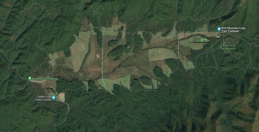 Satellite image shows how isolated this cultivated plain is among the mountains of the park.
Today, Cades Cove is an 11-mile one-way paved loop. There is no fee to drive around the loop, and there are several places you can park and get out to explore the preserved buildings and churches of early farmers. It is open daily from 8am to sundown (closed to autos on Wednesdays in high-season for bicyclers), and is popular partly because you may see wild turkeys, bear, elk, and other wildlife. Because of this, cars can move very slowly, and it can take four hours or more to complete the loop when the park is busy.
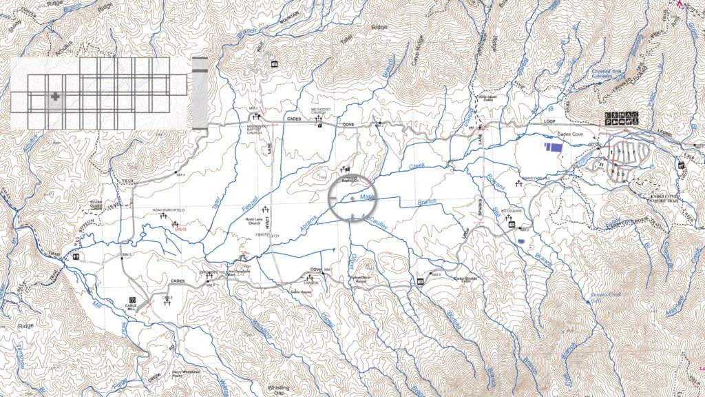 Geodetic map of the Cades Cove loop. Our trail starts at the far-west end of the loop.
There are also pull-offs where you can park and enjoy hikes at marked trailheads. One of these is our destination, a parking area at the end of a short gravel road at the far western-edge of the loop.
It was a comfortable day, highs expected to be in the low 80’s, and little chance of rain. As we entered the loop however, we could see that it was clearly raining in some places.
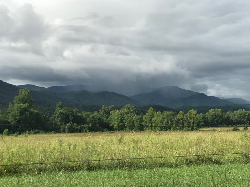 There’s rain in them thar hills!
There was indeed lighter than usual traffic when we arrived, and it only took us about 35 minutes to travel the 5-6 miles or so to the parking area. A quick check of our gear, and we were ready to explore!
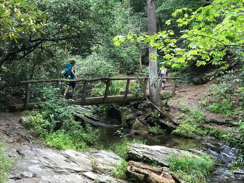
The trail starts with the first of four bridges over Abrams Creek, which flows beside the trail for most of its length – although sometimes well below the trail. The creek (and waterfall) were named for another Cherokee Indian Chief, Chief Oskuah, who later adopted the name Abram.
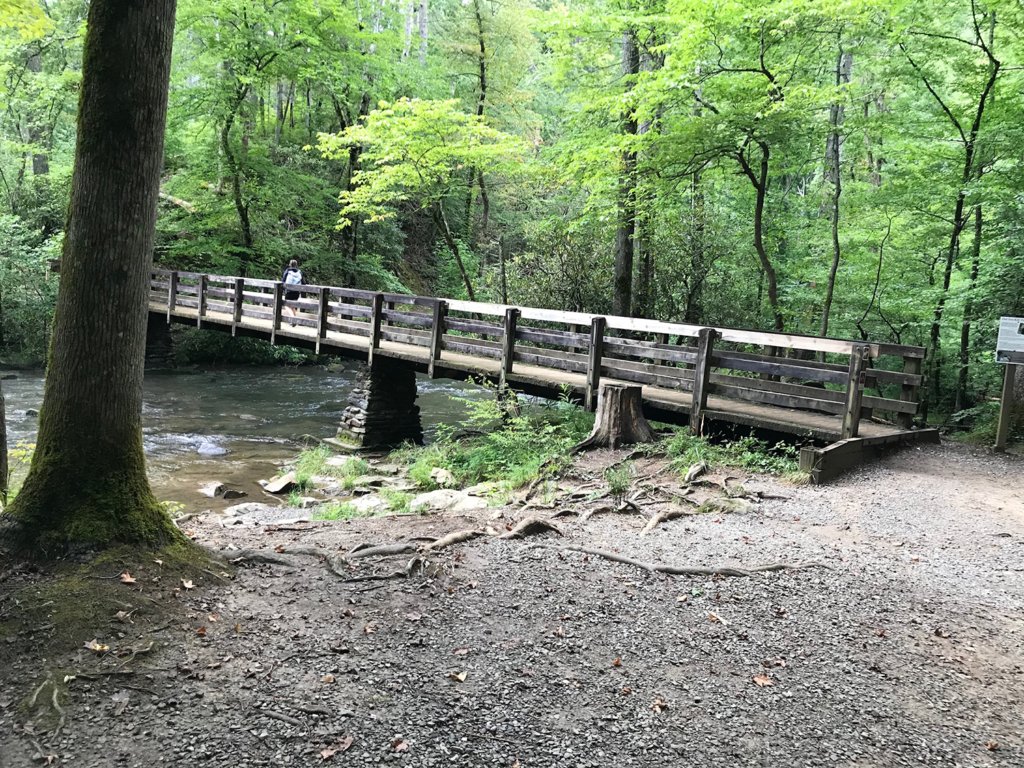 Entrance to the trail
The trail starts off very pleasantly, with the path meandering through the woods, accompanied by the sounds of Abrams Creek. This trail is rated as “moderate”, as most of the pathway is quite rocky and uneven, and you must take some care where you step. Also, this rating usually means there are some trickier patches and some uphill/downhill expected.
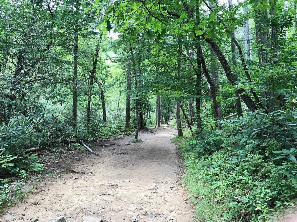 Easy path through beautiful forest
In the early going we are right at creek level for the most part, and there are some places to walk out on the rocks and admire the view, or do a little fly fishing.
 Taking a break to admire the view on Abrams Creek
As expected, we soon began to gain altitude, but we could still hear the stream below and catch glimpses of it through the trees. It was shaping up into very pleasant hiking weather.
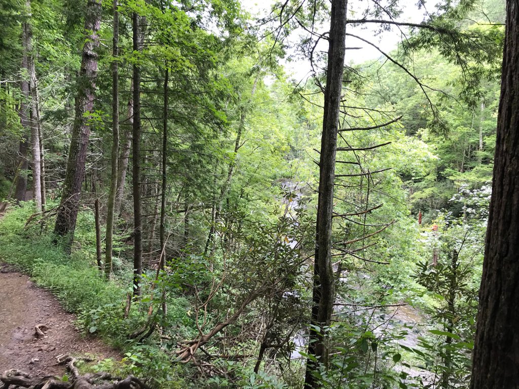 Looking down on the creek
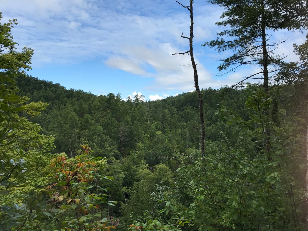 Great weather – so far!
Around the hour mark, when we figured we had traveled about two miles (I forgot to set my WalkMeter), the trail reached the trickiest section. We were on the top of a ridge, a good 300 feet above the creek, and had to negotiate a switchback over a granite pile, where it was not really clear exactly where the trail was – although we could see it heading off in a different direction and downward on the other side of the ridge.
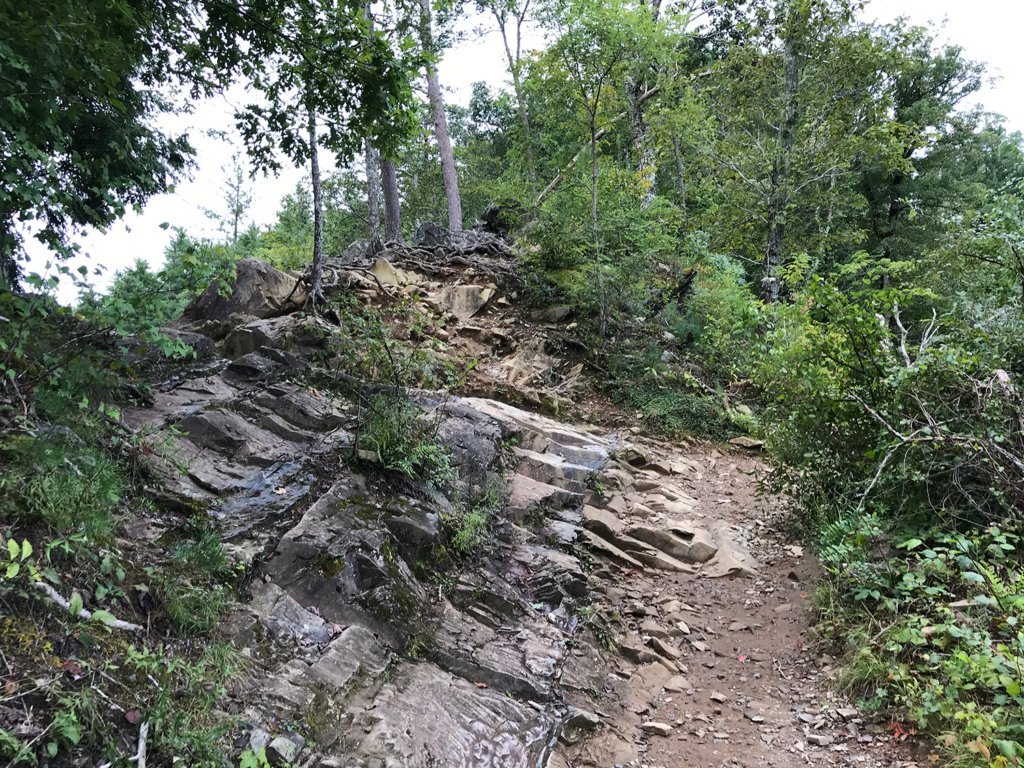 Looking back at the switchback after crossing the ridge
We found out later that this little jog across the rocks cut off a mile loop that the creek makes down the valley, so well worth a little bit of scrabbling.
From there it was mostly downhill, just a few rises, and we soon were able to hear the roar of what we assumed to be the falls.
Sure enough, one more log bridge to cross, and we were at our goal: Abrams Falls.
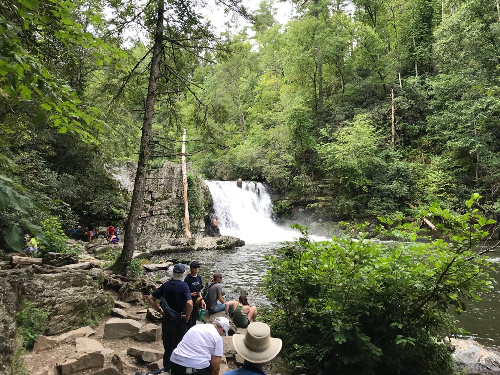 Abrams Falls
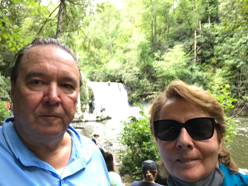
Abrams Creek is the longest creek entirely within the park system, and Abrams Falls creates one of the largest natural pools. It is very popular as a swimming hole as well as a fishing spot. We took off our masks (COVID-19 rules at the park), and enjoyed a lunch of ham and cheese sandwiches and the last two pieces of my homemade Blueberry Buckle sitting on a convenient rock.
Speaking of COVID-19 rules, although there were signs around the park requesting visitors to observe social distancing and wear face coverings where it was not possible, we were dismayed at how few tourists were taking it seriously. We were using our masks, pulling them up whenever passing other hikers, but less than 10% of the people we saw were taking any precautions.
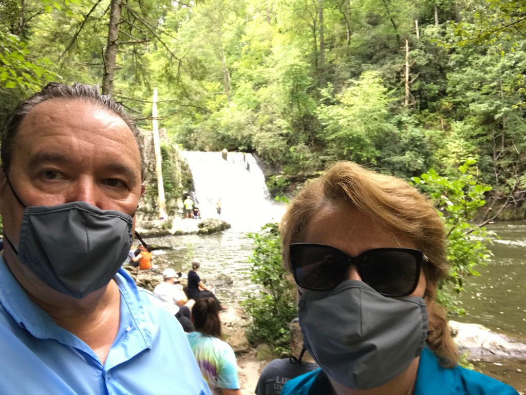 Who are those masked hikers?
 You must admit, I look better with the mask on.
After enjoying our food and view for a while, we decide to start back and give up our rock to other hikers. We got our packs back on, adjusted the straps, and crossed the bridge on our way back to the parking area.
 Rita on the way out
We didn’t get far before we ran into a father/daughter fishing team that were having a bit of a problem. Dad was wearing new shoes, and had a nice blister forming on one of his heels. Fortunately for them, as experienced hikers we had a first-aid kit with us which included moleskin, scissors, band-aids, and tape – so we stopped briefly to help them out.
Unfortunately, I do not have any pictures of our hike back. Shortly after our Good Samaritan stop, we noticed the sky darkening and a cool wind picking up. Soon raindrops started falling, so we paused once again to put away cell phones and put rain covers over our gear.
Almost as soon as we were done, the floodgates opened for real and it started pouring rain. Although it sometimes eased up a bit here and there, it was pretty much a steady downpour all the way back. The only good part of this, was with the rain there was no longer any need to wear our masks – exhaled water droplets cannot travel very far in a deluge.
It really wasn’t that bad, as it was around 80 degrees by that time and the rain was frankly kind of refreshing. The only problem I had was I learned there is a drawback to waterproof boots; when water gets in, it can’t get out.
I was wearing my nice Gore-Tex Lowa hiking boots, but water was dripping down my legs and into the spaces between my upper ankles and the boots, and wicking down the socks. Normally we would have had rain pants which cover this gap, but the day was too warm to want to bring them.
By the time we got to the car, I was able to pour about a cup of water out of each boot. Live and learn. Time to shop for some gators (they slip over the top of your boot on your lower legs and have an elastic band to help keep water out).
The only real problem the whole day was trying to get out of Cades Cove. It took us almost an hour to travel the last 5 miles. We found out the source of the backup when we got back almost to the camping area – a bear cub was up in a tree. Everyone was stopping or pulling over on the side of the road to try and get a look.
So it was a nice hike despite the rain, but a bit sobering too. It was just five miles and we only hiked about 400 feet in altitude, but we were done for the day. Last year in the Galápagos we were hiking seven or eight miles every day, and at the height of our Inca Trail training we would have barely felt the effort.
Definitely time to start taking some more hikes, and working at getting our legs back into shape. After all, the travel bans can’t last forever.
Can they?